Showing posts with label National Park. Show all posts

Thursday

Teluk Cenderawasih National Park

travelesia.co

Teluk Cenderawasih National Park is the largest marine national park of Indonesia, located in Cenderawasih Bay, south-east of Bird's Head Peninsula. It includes the islands of Mioswaar, Nusrowi, Roon, Rumberpon and Yoop. The park protects a rich marine ecosystem, with over 150 recorded coral species, for which it is considered a potential World Heritage Site

This is the playground of one of the world’s largest animals: the spotted whaleshark or rhincodon typus. If elsewhere in the world divers consider themselves lucky to meet one or a couple, here they come in pods and divers can swim along with them quite unharmed except to beware not to be hit by one of their powerful fins.

Scientist Dr. Gerald Allen calls the Cendrawasih Bay: “The Galapagos of Indonesia’s Reefs”.

Whalesharks are migratory animals, and are known to grow to 18 meters in length or more. Biologists tell us that they are an acient species originating some 60 million years ago, and are usually found in the open sea. They have a lifespan of 70 years. A 7 meter whaleshark can weigh up to 22 tonnes. Unbelievably these huge animals are docile since they live only on plankton, clouds of egg roe and small fish, which in Indonesia are called “ikan teri”.

In the village of Kwatisore near the town of Nabire, these giant fish usually gather by the floating platforms, called bagan, where fishermen haul in their catch of small fry.
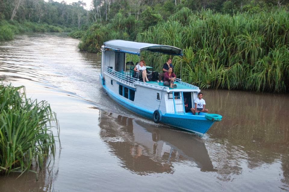
Kwatisore can be reached from Nabire in around three hours by boat with two 40pk outboard motors.The only accommodation available in this village are simple rooms at the SD Imanuel Primary School in Kwatinsore.  

travelesia.co

Here the local government trains 20 students to become dive guides and to develop facilities in Kwatisore to serve more tourists.

The Cendrawasih Bay Park combines coral reef ecosystems with mangrove, islands and terrestrial tropical forest ecosystems. Here are colonies of black coral, blue coral and soft coral. The Park is famous for the 209 fish species that make this Park their habitat, among which are the butterfly fish, the damselfish and parrotfish, and, of course the whaleshark, while mollusks found here include the trumpet triton, the great clam and the cone shell.

Comprising land and coastal areas, islands, coral reefs and pristine seas, the Cendrawasih Park covers a total area of 1,453,500 hectares. In 1990, the area was designated as Teluk Cendrawasih Marine Nature Reserve. The National Park was designated in 1993 and declared in 2002. The park is managed by Balai Taman Nasional .

wikimedia.org

How to get there?
From Jakarta, Surabaya, Denpasar, Makassar or Jayapura take a flight to Biak and on to Manogwari or Nabire. From Nabire take a longboat to the Park at Rumberpon Island, which takes some 5.5 hours. Or, to visit the whalesharks, take a boat to Kwatisore village from Nabire. The journey takes about 3 hours.
To visit the Park, contact the Office at:
Jalan Trikora Wosi Rendani, PO Box 220
Manokwari 98312, West Papua
Tel.: 62-986-212212
Fax:  62-986-212437
Email: manokwari.wasantara.net.id


Saturday

RAJA AMPAT NATIONAL PARK PAPUA- Your Personal Disneyland of Diving Sites


Raja Ampat casts a spell on all who visit – scientists, photographers, novice divers and crusty sea-salts alike. This group of majestic islands, located in the northwestern tip of Indonesia’s Papuan “Bird’s Head Seascape,” lies in the heart of the coral triangle, the most bio-diverse marine region on earth.

As stunningly beautiful above water as it is below, Raja Ampat (which literally translates as “The Four Kings”) has a startling diversity of habitats to explore. Each of these – from the stark wave-pounded slopes that drop away beneath the karst cliffs of Wayag and Uranie to the deep, nutrient-rich bays of Mayalibit, Kabui and Aljui to the “blue water mangrove” channels of Kofiau and Gam to the plankton-rich upwelling areas of Misool and the Dampier Strait – are home to unique assemblages of species that, when taken together, add to produce the most impressive species lists ever compiled for a coral reef system of this size.
 
Marine tourism, as a sustainable alternative to overfishing, mining, and logging, has the potential to play a key role in the conservation of Raja Ampat’s spectacular underwater realm, while also creating real benefits for the local communities. This website was designed as part of a larger effort to support the growth of sustainable marine tourism in Raja Ampat and the conservation of these magical islands.

Please explore this site to find information on breathtaking diving opportunities, travel logistics, Raja Ampat’s new tourism entrance fee (which directly supports conservation and community development), and the tremendous conservation effort taking place in Raja Ampat. 

The roaring engines fixed to a large wooden boat are finally quiet. Nothing can be heard but the rifting little waves, lapping against the vibrant paint on the sides of the vessel that gracefully slows down. Native birds hop on the tip of a small tree in one of the deserted islands in the distance.

Raja Ampat or ‘Four Kings’, is the name given to these islands and comes from a local myth. The four major islands found here are Waigeo, Misool (which is home to ancient rock paintings), Salawati, and Batanta.
 

Underwater enthusiasts flock to this region because it offers the world’s best marine sights. Two days earlier, some of these travelers had been at a deafening corner of a tourist trap in Bali. Once they took their flight to the bird head of the island of Papua everything changed as they embarked on a diving tour of a lifetime. In the Raja Ampat islands, divers can explore vertical underwater walls. The thrill of drift diving is another great challenge. These are the awesome experiences you will find in Raja Ampat.

Meanwhile, on this tour several divers were well equipped and looked advanced. The territory within the islands of the Four Kings is enormous, covering 9.8 million acres of land and sea, home to 540 types of corals, more than 1,000 types of coral fish and 700 types of mollusks. This makes it the most diverse living library for world’s coral reef and underwater biota. According to a report developed by The Nature Conservancy and Conservation International, around 75% of the world’s species live here. When divers first arrive here their excitement is palpable. It’s common to hear people praise God as they take in the remarkable scenery. Others prefer to remain in silence taking in the overwhelming sight of so many islands with crystal clear water that softly brushes over the white sandy beaches.

“Disini bagus!”, says the friendly local guide who had been appointed by the tour operator who runs an eco-lodge in Raja Ampat, indicating that they have arrived at one of the most fantastic diving sites. On other days, this guide is just a simple fisherman. The local fishermen here are accustomed to foreigners and are friendly, especially when offered pinang (betel nuts) or some sweet candies. These are very popular and offering these sweets is considered polite and a good way to win an instant smile. The fishermen usually eat this snack during Para-para Pinang, or social chatting and exchanging funny stories while chewing Pinang. In many respects, like nature, culture, and history, these fishermen are closer to the Moluccas.
 

"No doubt about it, Raja Ampat is definitely the richest place for fish that I have ever been." -Dr G.R. Allen

"I was like a five-year-old, seeing a reef for the very first time. I was awestruck, held by the incredible power of this richest reef. We must, with all available resources, preserve the beauty of Raja Ampat. This may be the last frontier." --Michael Aw

"I love the people, I love the diving, it's super! I've never been for a second time to the same dive destination but now I'm thinking about going back for the third time! Should I say more?" --Peter van Dalen
 
 While the landscape may look like a dream, this is not an illusion. As you embark on your dive, the phrase ‘Attention to detail’ takes on new meaning as pigmy seahorses swim around your fingers. Manta Rays and wobbegongs will glide right by you. Tuna fish, giant trevallies, snappers, and even barracudas are there to complete your underwater ‘meeting list’. Not to mention the friendly assistant of the dugong, and a busy colleague, the turtle. Natural and untouched beauty is the main attraction here. With no unnecessary adages, the sky, the lush islands, the sea, and everything above and under it is genuinely saying ‘Welcome to Raja Ampat Islands; your personal Disneyland of diving sites’.


http://www.rajaampatsailing.com

Danau Sentarum National Park- Representative of Wetland Ecosystems


Danau Sentarum National Park is a national park protecting one of the world's most biodiverse lake systems,  located in the heart of Borneo Island, Kapuas Hulu Regency, West Kalimantan Province, Indonesia. The Danau Sentarum National Park is representative of wetland ecosystems lakes, freshwater swamp forest and tropical rain forest in Borneo. Approximately half of the park consists of lakes, while the other half consists of freshwater swamp forest.

The Danau Sentarum National Park (DSNP) ,is located in a remote area of the upper Kapuas River called "Kapuas hulu" in West Kalimantan province, of Indonesia Borneo, and situated close to the Malaysian border of Malaysian Sarawak, and is approximately 700 km. inland from the West Kalimantan provincial capital, Pontianak. The Danau Sentarum National Park is an area of connected big lakes and seasonally flooded by the tropical rains, as the water streams down from the cloud Rain Forest hills of the surrounding area.

The Danau Sentarum National Park is approximately 30-35 m. above sea level, while the surrounding hills are situated as high as 750 meter above sea level. Daytime temperatures are consistently between the 26-30 degrees Celsius, The driest months are usually July, August, and September. The area was established in 1985 as the Danau Sentarum Wildlife Reserve. While the borders are unclear, the main part of the park is around 1250 square km

Several Longhouses are found in the area of Danau Sentarum National Park, The Iban longhouse of Sungal Sedik is located about 6 km. from the district center of Lanjak. The longhouse was a 14-household community containing about 100 residents. The Sedik River territory is a hunted area for the members of the at least five other longhouse Dayak communities of Lanjak. 

West Kalimantan 's Danau Sentarum National Park wildlife has 120 species of fish, Among them are the Asian bony tongue, toman, betutu, jelawat, belida, ketutung, and the beautiful clown loach. Other animals like proboscis monkey, orangutan, estuarine crocodile, siamese crocodile, clouded leopard, great argus pheasant, false gavial, and wooly-necked stork also inhabit this national park.

Some locations / attractions to be visited:
Lanjak hills, Nanga Kenelang hill and Tekenang hill. A panoramic view of the lake, boating and wildlife observation and study of birds equipped laboratory facilities.

How to get  there :
To reach the location: Pontianak-Sintang-Semitau using a four-wheeled vehicle about 11 hours or Sintang-Semitau longboat (Bandong) taken about seven hours. Semitau to the location using the motor boat to Lanjak. Pontianak-Putussibau with aircraft about two hours and Putussibau to Nanga Suhaid with longboat about seven hours.

Easy way  touring this Indonesian secret place, you are be abe dealing with De'Gigant Tours™. They are the Trade Mark of the company named PT. Gigantara® as an under Indonesian Law Based Tourism Company, owned by  Lucas Zwaal and Drs. HS. Fathan who have more then 20 years experience in Hotel and Tourism Industry, specially at the Indonesian part of Borneo.
Office Address:
De'Gigant Tours™ ( PT.Gigantara® )
Jl. Martadinata Raudah 1 no 21
Samarinda, East Kalimantan, Indonesia
Phone +62 541 7091536
Fax +62 541 7778648
Hot Line +62 8125846578 ( 24 hours )
info@borneotourgigant.com


Background and Permits
Official Tourism Permit number : 556.7/1443/UPT/IX/2008
Company Permit number : 503/2668/729.G/BPPTSP-C/IX/2011
Company Tax number : 02.828.505.4.722.000
Company Employee Registration Number : 043602011

Satulingkar.com
Bumisme13.blgogspot.com


Tuesday

Tanjung Puting National Park - The world's Largest Orang Utan Conservation.


Tanjung Puting National Park is a national park in Indonesia located in the southeast part of West Kotawaringin Regency in the Indonesian province of Central Kalimantan (Central Borneo). The nearest main town is the capital of the Regency, Pangkalan Bun. The Pangkalan Bun City is the main gateway to get the Tanjung Puting National Park.

Tanjung Puting sits on a peninsula that juts out into the Java Sea. The peninsula is low lying and swampy with a spine of dry ground which rises a few feet above the omnipresent swamp. The north of Tanjung Puting is characterized by gentle hills and gold-bearing alluvial plains. In the past maps of the region commonly portrayed a ridge of mountains coming down into Tanjung Puting. This mountainous ridge does not exist; in fact, nowhere does the altitude rise above 100-200 feet in Tanjung Puting.

Tanjung Puting National Park (TPNP) is famous for its Orang Utan ( Pongo pygmaeus) conservation, Certainly,  the world's largest Orang Utan conservation. The population of Orang Utan is estimated at 30,000 to 40,000 Orang Utans are scattered in national parks and also outside the national park.

Tanjung Puting National Park is the first location in Indonesia as an Orang Utan rehabilitation center. There are three locations for the rehabilitation of Orang Utans in Tanjung Harapan, Pondok Tanggui, and Camp Leakey.

Tanjung Puting National Park  are also a place of endemic and endangered species protected in the Tanjung Puting National Park such as  Orang Utan (Pongo Satyrus), proboscis monkey (Nasalis larvatus), red leaf Langur (Presbytis rubicunda rubida), bear (Helarctos malayanus euryspilus), deer (Tragulus klossi javanicus), clouded Leopard (Neofelis nebulosa), and cats (Prionailurus borneoensis bengalensis).

Tanjung Puting National Park is covered by a complex mosaic of diverse lowland habitats. It contains 3,040 km2 (or 1,174 square miles) of low lying swampy terrain punctuated by blackwater rivers which flow into the Java Sea. At the mouth of these rivers and along the sea coast are found nipa/mangrove swamps. Mangroves teem with animal life. Tanjung Puting also includes tall dry ground tropical rain forest, primarily tropical heath forest, with a canopy of 30 meters (approximately 100 feet) with “emergents” exceeding 50 meters (approximately 165 ft) in height, seasonally inundated peat swamp forest with peat in layers two or more meters (approximately 7 feet) deep, open depression lakes formed by fire, and open areas of abandoned dry rice fields now covered with elephant grass and ferns. The tropical heath forest which is called “kerangas” in parts of Borneo, is only found on very poor, typically white-sandy soils and is characterized by medium-sized trees.

Even


The International Ecotourism Business Forum  to 9 in September of 2013 was held in West Kotawaringin. The event was attended by 14 international travel agencies and 19 national tourist agency.


How to get there
Tanjung Puting National Park is located in District Kumai, West Kotawaringin the capital of Pangkalan Bun, Central Kalimantan. To get to Pangkalan Bun there are a number of ways;
  1.  For those who start from the city of Banjarmasin (South Kalimantan) can ride the bus to Palangkaraya and then to Pangkalan Bun
  2.  Also there are a Pelni ship directly to Kumai port from Surabaya and Semarang, usually go 2 times a week, to make sure the schedule can directly contact Pelni.
  3.  You can also take a flight to the Iskandar Airport at Pangkalan Bun from Jakarta or other main Indonesian cities. Now there are Trigana Air and Kalstar flight served toward Pangkalan Bun City.
  4. From Kumai to Pangkalan Bun you can ride taxi ride (about Rp. 160,000), or ride motor rental (IDR 25000-40000) and public transportation (Rp 5,000).
  5. The trip down the Tanjung Puting National Park should use the boat (called kelotok by people in Kalimantan) for a few days. You will live there on klotok, and there you shower, eat and sleep and everything was done above your board. You will get an amazing experience during this trip to the Tanjung Puting National Park.


The important thinks you should know:
  1.  You could also hire speedboad from Kumai for saving time. And better start in early morning.
  2. Do not forget to buy tickets at the National Park office in Kumai before entering, there will be an additional charge for camera, boat parking etc
  3. Entrance to Tanjung Puting National Park is start at Kumai River then into the Sekoyer River and Lakey River with black watery, and be careful of crocodile.
  4. Travelers who wants to try jungle track have to be accompanied by a travel guide.
  5. There are three camp is usually used  to see Orang Utan at the feeding hours, at Camp Tanjung Harapan, Pondok Tanggi and Camp Lakey.
  6. Feeding Hours at Camp Tanjung HArapan  at 14.00, at Camp Pondok Tanggi at 9:00 and at Camp Lakey 14.00.
  7. Discuss which your guide traveler first before continue your journey.
  8. Do not forget to bring mosquito repellent

Hotels
There  are some nise hotels in Pangkalan Bun, Such as:
  1.  Swiss-Beli Hotel Pangkalan Bun  Jl. Ahmad Yani KM.02, Pangkalan Bun, Kalimantan Tengah, 74113 Pangkalanbun
  2. Grand Kecubung Hotel  Jalan Domba No. 1, 74111 Pangkalanbun.
  3. Hotel Tiara  Jl.Pangeran Antasari no. 16, 74115 Pangkalanbun
  4. Hotel Bahagia  Jl. Pangeran Antasari No.100, 74115 Pangkalanbun
  5. Hotel Mahkota  Jalan Pangeran Antasari no 303, 74114 Pangkalanbun


Friday

Way Kambas National Park -Elephant Protection Park


If you want to see an elephant, came to the Way Kambas National Park.

Way Kambas National Park is a national park for elephant protection, located in Lampung,  Indonesia, has an area of ​​125 621 hectares is designated as a national park by the Minister of Forestry Decree No.. 670/Kpts-II/1999.670/Kpts-II/1999.

Way Kambas National Park established in 1985 is the first elephant school in Indonesia. with the initial name of Elephant Training Center (PLG), but since the last few years the name was changed to Center for Elephant Conservation (PKG) which is expected to be the elephant conservation center in taming, training, breeding and conservation. Until now PKG has trained about 300 elephants that have been distributed to all over Indonesia.
Way Kambas National Park, Beside you can enjoy elephant at the Elephant Training Center, you can also surround the National Park while riding the trained elephants. Sitting on them, and touring around the park's forests, will be unforgetable journey in Way Kambas National Park.

The awesome attractions at Way Kambas National Parks is elephant dancing. Elepahants are able to dance with musical accompaniment skills in circus performances. For example, play ball, shake hands, respectful, draping flowers, tug of war, and swimming. Beside You can also ride elephants.

In this National Park, elephants are not only one thing that you can see. There are many other interesting wild species life. Such as partridge sumatera (Galus varius), wild boar, deer, monitor lizards, grouse, python snakes, Sumatran tiger (Panthera tigris sumatrae), tapir (Tapirus indicus), coyotes (Cuon alpinus sumatrensis), gibbon (Hylobates syndactylus syndactylus); and 406 species of birds including wood duck (Cairina scutulata), stork (Ciconia episcopus stormi), snake (Anhinga melanogaster); and various types of reptiles, amphibians, fish, and insects.

The Whole interesting sights in Way Kambas National Park are:
  •  Elephant Training Center
  •  Elephants Attractions
  • Tour Elephant, day and night
  •  Observation of the evening wildlife including observation of migratory birds
  •  Sumatran rhino breeding and research in the Right Way
  •  Ecotourism Along the River Way Kanan
  •  Camping Ground
  •  Mangrove forests

How to get there:

There are two ways to get to Way Kambas National Park :
  1. Flew and landed in RadinInten II Airport (it is a domestic airport that serves the city of Bandar Lampung) in Lampung, Indonesia. And ride bus or rent car from Bandar Lampung - Metro - Way Jepara along 112 km.
  2. From Jakarta to Lampung by crossing the Sunda Strait by ferry. This trip may be more enjoyable. Crossing over from Jakarta to Merak Bakauheni, took about 3 hours to cross the strait. And continue to Labuan Meringgai - Way Kambas via bus or car  (its about 170 Km)

For more information: Call Way Kambas National Park's Office

Jl. Raya Way Jepara, Labuan Ratu Lama, Lampung
+62 (0725) 44220

Thursday

Wakatobi National Park


Wakatobi National Park is a marine national park, South-east of Sulawesi island of Indonesia. Wakatobi National Park is located south-east of Sulawesi, between 05°12’-06°10’S and 123°20’-124°39’E, between the Banda Sea to the north-east and the Flores Sea to the south-west. It consists of four larger islands: Wangi-Wangi, Kaledupa, Tomia and Binongko, as well as many small islands such as Tokobao, North Lintea, South Lintea, Kampenaune, Hoga and Tolandono. The highest elevation is 274 metres (899 ft) on Wangi-Wangi, followed by Lagole Hill (271m) on Tomia, Terpadu Hill (222 m) on Binongko and Mount Sampuagiwolo (203 m) on Kadelupa. The water depth varies, with the deepest parts reaching 1,044 metres (3,425 ft).

Wakatobi National Park is one of largest marine national park in Indonesia. Coral reefs and fish are main focus in managing and it is become important things. Coral reef ecosystems assessed as coastal marine ecosystems are very productive that can be found in tropical waters. Ecologically, coral reefs play an important role as habitat for reef fish communities are targeted by fishermen.

Wakatobi waters are located in the coral triangle area, those areas are coral reefs Whose diversity and biodiversity are highest in the world, consists of Philipines, Indonesian untill Solomon Island.

In Wakatobi you can enjoy diving 365 days a year. There is no period or season unsuitable for diving, and we have skipped only 4 dives in the last 10 years. The climate is drier than in other parts of Indonesia, and the location is quite protected by the surrounding reefs and islands.

The types of vegetation found in the national park are mangrove forest, coastal forest, lowland swamp forest, riverbank vegetation, lowland rainforest, mountain rainforest and coral reefs. The Wakatobi Archipelago has 25 groups of coral reefs including fringing reefs, barrier reefs and atolls. A survey conducted in 2003 identified 396 species of coral belonging to 68 genera and 15 families. These include Acropora formosa, Acropora hyacinthus, Psammocora profundasafla,Pavona cactus, Leptoseris yabei, Fungia molucensis, Lobophyllia robusta, Merulina ampliata,Platygyra versifora, Euphyllia glabrescens, Tubastraea frondes, Stylophora pistillata, Sarcophyton throchelliophorum, and Sinularia species

At this time, Wakatobi has about 750 species of coral and 942 species of fish. In addition, there are also coral beach area or coral reef about of ​​118,000 hectares  and coral atolls along 48 kilometers. Its named Kaledupa Atoll, this coral atolls is the largest in the world.
After the designation of the Wakatobi Marine Conservation Area in 1996, the Wakatobi National Park with a total area of 1,390,000 ha has been established in 2002. It is managed by the Wakatobi National Park Authority (Balai Taman Nasional). In 2005 the park has been listed as a tentative World Heritage Site.

The United Nations Educational, Scientific and Cultural Organization (UNESCO), inaugurated Wakatobi, Southeast Sulawesi as a Biosphere Reserve Earth (CBB). The inauguration was marked by the CBB certificate by the Minister of Forestry Zulkifli Hasan to Wakatobi Regent, Hugua, Tuesday night, May 14, 2013.

To reach the main gate of Wakatobi National Park  and District Wakatobi is the Wangi Wangi Island, this island is known by  "Wanci". From the Kendari (the capital of the  Sulawesi Southeast Province), Wanci can be reached through sea travel. There are 2 routes to travel toward the sea from Kendari to Wanci. There are routes Kendari to Bau-Bau to Wanci, and routes Kendari to Wanci. Route Kendari - BauBau - Wanci can be reached by using a fast ship (Motor Vessel), It takes  ± 5 hours.  And from Bau-Bau to Wanci using wooden ship for ± 9 hours.

Route Kendari - Wanci can be reached by regular wood ship 2 times a week and takes about ± 12 hours. Among the four major islands at Wakatobi, Wangi-Wangi Island has the highest accessibility and serves as a central capital of Wakatobi.

Wakatobi National Park Authority
Jln. Dayanu Ikhsanuddin 71
Bau-Bau, South-east Sulawesi
Tel / Fax: +62402 2826326 

For Wakatobi dive resort see more at  http://www.wakatobi.com


Mentawai Island and Mentawai Surf Adventure


Mentawai is one of the districts in Indonesia, located in the province of West Sumatra. Mentawai District consists of four main island, are Siberut Island,  Sipora Island, North Pagai Island  and South Pagai island that inhabited by a majority of the Mentawai tribe

Mentawai tribe is a primary resident in this district, Most of the residents of this islands in comes from Siberut. Mentawai tribe communities have a bit of ancient cultures. Half of the population in this district are animists, others are Christian and Islamic. After the independence day of Indonesia, these people in this district have to mingle with other tribes that exist in Indonesia.

On the Siberut Island there are a Siberut National Park. Siberut National Park is a nature conservation area which has a native ecosystems, which can be utilized for scientific purposes, as well as also for the culture and tourism.


Siberut island is 155 km from the city of Padang. Siberut National Park has 60% area covered by primary forest Dipterocarpaceae, a mixture of primary forests, swamps, coastal forests and mangrove forests. This National Parks has many large trees with an average 60 meters height.

Mentawai Islands is a famous and beautiful beaches. They has a high waves and very suitable for surfing activities (surfing). Surfing is an icon for Mentawai island and that has been famous throughout the world. The international surfing competitions have been held here. No less than 400 "Surfing Spot"  that can be used as a surfing location. Waves in the Mentawai islands surf  is the third best after Hawaii and Tahiti. Most visit time occur in July and August. It was the time of the waves reaches 7 meters.


Surfing activity can do at several beaches located in the Mentawai islands.  Nyangnyang beach, Karang Bajat beach, Karoniki Beach, and Pananggelat Mainuk beach which all of the beaches are located in the District of South Siberut. In other side, in  District Sipora there are also several beachessuch as Katiet Bosua beach and the South beach. And in the District of North Pagai there is the West Coast. Mentawai sea has a fantastic wealth and potential seabed. The extreme high waves making the Mentawai as one of the popular tourist attraction in the world surfing.


Surfing activities usually conducted on April to October. Becouse the waves in these months reaches the highest level and the surfers can use it for surfing. Meanwhile, it is not happen in November to March, so not challenging enough for surfing.

Access to the Mentawai islands is from the Padang City, the capital of West Sumatra. There is a Minangkabau International Airport. The daily flights from Jakarta and Medan. There is also a Garuda and Silk Air from Singapore, and Air Asia from Malaysia.


From the Padang City towards the Mentawai islands can be reached using sea and air transportation. No ground transportation. Sea transportation is served by KM. Ambu-Ambu with a scheduled route. In addition there are also rental boats provided by other private companies. And the air transportation using only small aircraft with the flight schedule is not every day.

Resort in mentawai island:

1. The resort of Botik is situated in the north part of the island in front of the islands of Mainuk and Nyang Nyang.  It has two private bungalows of approximately 100 square meters to sleep four people very comfortably. Large rooms and a lot of space ar

2. Hosting guests since 1998, WavePark Mentawai Surf Resort is the original full service land-based surfing resort in the Mentawai Islands, West Sumatra, Indonesia. Our all inclusive price includes a private chartered speedboat transport from mainland Sumatra to Mentawai and return, guided surfing and fishing speedboat service, 3 meals a day, drinks, snacks and accommodation on the island. With a maximum capacity of 12 surfers, the WavePark Mentawai surf resort guests have the entire island for their exclusive use.
Located in northern Mentawai near the Playgrounds anchorage, the wave park offers 21 different waves to choose from that we have designated beginner, intermediate and advanced. We are proud of our extensive knowledge of secret Mentawai waves as well as Mentawai weather conditions; built up from our combined 20 years of experience hunting waves in the wave park area. With unrivaled speed and comfort between lineups you will get better surf, more often with less crowds.  http://www.wavepark.com/

3. Welcome to Mentawai Surf Camp a private 3 bedroom guesthouse catering for just 6 people. Situated amongst the world renowned waves of “Playgrounds” in the Mentawai Islands.  Our beach front location, with views towards Beng Beng (and other waves), is second to  none. We proudly boast a number of waves within just 5 minutes from our shore aswell as nearly 20 world class waves within 35-40 mins. http://www.mentawai-surfcamp.com/


Saturday

KOMODO ISLAND


Komodo Island is an island located in the Nusa Tenggara Islands. Komodo Island is known as a habitat for native animals Komodo. This island is also the Komodo National Park which is managed by the Central Government. Komodo Island located in the eastern island of Sumbawa, which are separated by the Sape Strait. Sub District of Komodo, West Manggarai District, East Nusa Tenggara Province, Indonesia. Komodo Island  is the most  faraway at Nusa Tenggara Timur Province, bordering the West Nusa Tenggara Province.

Komodo National Park includes three major islands: Komodo, Rinca and Padar, as well as numerous smaller islands creating a total surface area (marine and land) of 1817km (proposed extensions would bring the total surface area up to 2,321km2). As well as being home to the Komodo dragon, the Park provides refuge for many other  notable terrestrial species such as the orange-footed scrub fowl, an endemic rat, and the Timor deer. Moreover, the Park includes one of the richest marine environments including coral reefs, mangroves, seagrass beds, seamounts, and semi-enclosed bays. These habitats harbor more than 1,000 species of fish, some 260 species of reef-building coral, and 70 species of sponges. Dugong, sharks, manta rays, at least 14 species of whales, dolphins, and sea turtles also make Komodo National Park their home.

 In the Komodo island, Komodo lives and breed very well. by August 2009, on this island there are about 1,300 Komodo (Varanus komodoensis). If it is include with other islands, such as Rinca Island and Gili Motang island, their totaled about 2500 komodo. 

Traveling to visit this endangered animal can be done through Labuan Bajo or Sape on Sumbawa Island to the east. However, advisable to go through Labuan Bajo because the distance is only around 3 hours journey by motor boat.

The most amazing in traveling or touring to Komodo National Park is that we can see from the close of this endangered animal activity, Komodo. During the trip you can see the beautiful natural scenery. In the vicinity of  Flores, there were 60 islands. However, the most frequently visited are the Rinca Islands and Komodo Island.

For tourists who love trekking, they can cross the field accompanied by an officer. On this island, komodo endangered animals could be found. However, this reptiles  is rarely seen in the daytime. Becouse if there is sun light and heat temperature  Komodo likely to take refuge in their burrows or under trees.